Navigating Overseas without a GPS
Sometimes living in the US we forget that not all countries have the same benefits as we do, specifically being able to own a GPS . In certain countries you can be arrested and jailed just for having one (most likely in those countries where they think everyone not from there is a spy if you get my drift). (see my #2 comment below for clarification, sort of)
While working overseas on a contract for the government we used various models of GPS’s in our work, travel to unfamiliar and remote areas was common. While we were all issued a Garmin we found that it was not really the best item for navigation, it was an outdated model, the maps for the country we worked in cost $300 and usually would cause the GPS to lock up if the full map was loaded. Then on models like the Garmin CS60 the screen is pretty small and buttons not as user friendly as they could be, it’s a good model for hiking but not for navigating a hostile and unfamiliar area while driving as fast as you can.
A few years into this job the local security services tried to confiscate GPS devices from anyone going through the airport. Citizens of that particular country are not allowed to own a GPS, some still do but those are illegal. The other problem was downloading map updates, I had a subscription to download updates but my foreign IP address was restricted from downloading them. So the dilemma was do I take a chance on trying to sneak my GPS home and having issues at the airport just to update my map set?
Then we learned of an incident in another country with someone traveling with a GPS, it was a common first place to stop for people departing the country we worked in. The person was stopped and found with a GPS in his luggage, he was held for hours while being questioned by the local authorities. This was one of those places where you really DON’T want to end up in one of their prisons being called a spy. Lucky for the individual he was smart enough to take out the memory card with the overseas map set and insert one from his home country, he was able to show them the maps for where he lived. It could have turned out a much worse.
So what do you do if you can’t take a GPS on your overseas trip to an unfamiliar area?
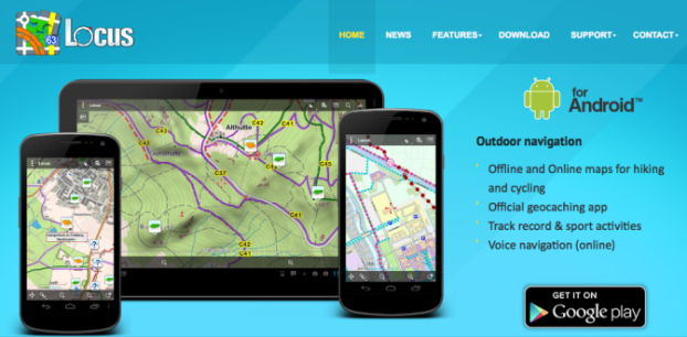
Get a Samsung Galaxy Tab. Well, you’ll also need a program called Locus. There is a FREE version and a PRO version, spend the $8 and get the PRO version, it has a few more features and no annoying ads.
Luckily we had a guy on our team who was a real whiz with computers. One day he showed us this new tablet he bought and the GPS program he had downloaded. At first I was skeptical, and cheap, I just didn’t want to buy another toy that I might not use later and I already had an iPad. I have to admit it was well worth buying. Not only is the screen bigger than a handheld GPS, but the features of Locus are superior to any GPS that I have used so far.
The great thing about using Locus and the Galaxy Tab is that once you get it setup it has great features for advance work or even the solo agent. I’ll admit the setup is not the easiest, but once done and you learn the features it’s a nice touch screen GPS with loads of features. There is a “right screen” feature that lets you put buttons on the right side of the screen, once you have that setup recording a track or adding a waypoint is a matter of touching a button. You can take pictures for your advance and associate them with the waypoint, then share those files with team members. You can import routes you made on Google Earth, use overlays and a few other things I’m sure I’ve forgotten.
When I left that job overseas the map set, including our waypoints, tracks, and all other information was around 2GB in size. We had roughly 800+ venue locations listed in Locus divided by cities, numerous tracks that I had saved, pictures of venue locations, etc. We did try a few programs that would let us track every team member that was using this system, however you needed to have a cellular card in your tablet and for security reasons we chose not to do that. That would work well here in the US, but in certain foreign countries I’m not so sure I would trust having my entire teams locations being broadcast like that.
Make sure you get a tablet with sufficient memory (more is better in this case), or even an additional memory card. With Locus you don’t need to purchase any maps, you simply download Google Earth maps of an area you define and select all the zoom levels you want, then save them on the tablet. Of course I would suggest you do this where you have a good fast internet connection. One word of caution, you don’t need every zoom level of the map as that will slow down the device and I believe there is a daily download limit as well.
Also download another free program called Locus Map Tweak, it allows you to download maps from a number of other good sources.
The number one benefit and really the point of all of this is, it’s just a tablet, it won’t be noticed like a GPS would so the chances of you being arrested in a foreign airport as a spy are pretty slim compared to having a GPS in your possession. The other is if you are the advance person you can download maps for a certain city, do your advance and save the information about that city, then turn it off when you are done and move on to the next city. Each city or area can be saved in it’s own folder, then shared with team members.
Lastly, I’ll make no secret that I’ve been a die hard Apple fan for a long time now, I’m constantly going through the App Store looking for a good navigation program for my iPad. To date nothing has convinced me to use the iPad as a navigation device, I still haven’t found a navigation app that was this good so if you know of one that is similar to Locus by all means let me know. For the Mac users out there you can download a program called Mac Kies, this will let you connect to your Apple devices. There is also Mac Kies Mini for those using smaller Android devices (phones).
Safe Travels!